GPS in the field
how to use the GPS units in the field for populations or habitats mapping
First we have to get a GPS unit. They are quite expensive, especially the ones which are performant and have the basic tools for mapping the populations and habitats. A good basic one can be bought for the money you would spent on a basic fridge, washing or cooking machine. But all-in-all you would utterly need one in the reason to get useful GIS data on the field about the species and habitats of interest.
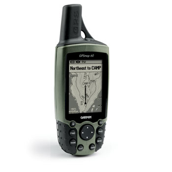
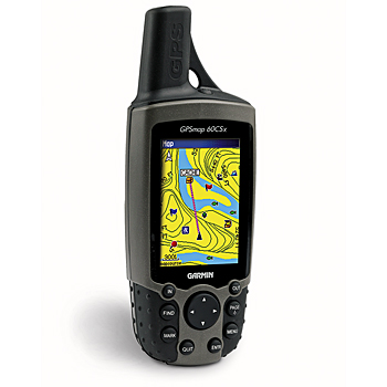
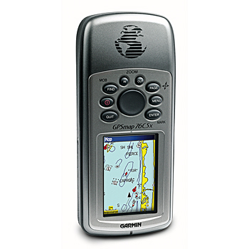
Would you like a recommendation? This would be, from our experience the basic and friendly Garmin GPS 60 or GPSMap 60 which has all the basic tools you need and are surprisingly precise in comparison with the much more expensive and "performant" Garmin GPSMap CSx60 and GPSMap CSx76 which have color screens, expandable memories and topographical maps (like Garmin RO.A.D. 2008 Romania) which can be inserted by using microSD cards, but surprisingly have been proven to be dissapointingly much less accurate in locating precise points or tracing small polygons around small populations.
As most of the Romanian naturalists prefer Garmin for their search we will refer to these units in the following paragraphs. If a person has experience with Magellan or other kind of units in this respect we invite him or her to send his or her experience to be published here. However we underline that the car navigators GPS units are useless in the field. First of all, their batteries last usually less than three hours, they are unable to create exportable tracks which is a prominent important feature for our scope and finally are generally less accurate in pinpointing precise locations. Keep in mind that car navigator GPS units are built not fot trekking (though their manuals sometimes pretend they are as useful offroad as inside cars) but for navigation with a vehicle on a street web.
Why GPS and GIS? This is the only way to obtain an exact mapping of the populations of the species of a great interest in order to have a realistic view of the evolution of their populations through time. These methods have no alternatives and the former banal indications that mention the presence of a species on a place but say nothing about the local ecology and local demography of a population are not a match for the condition of our time. Now humans pose a lot of pressure upon the natural populations driving them to rapid extinction. Without a clear image of what happens to them there is no way to get back the tide of extinction that follows the actual expansion of the humans at the expense of the natural habitats remained.
Garmin GPS 60 We found this unit as the basic tool you need for mapping populations and habitats in the field. It is robust, waterproof and has provided us with excellent accuracy. Though a disadvantage can be the small internal memory (1MB) the inability to insert microSD cards to expand the memory and thus to load topographical routable maps, we found this device very good in all the situations. It can be ordered in Romania here for something like 750 RON. Remarkable, the cover of the unit is always made of a distinctive bright yellow-colored plastic. We found this particularly good becuase if you loose the unit on the field, for example in deep grass you will find it much easier than in the case of the following types which have dark colored cases.


Garmin GPSMap 60 . ('Map' comes from the fact that routable maps can be loaded in the internal memory of the unit). Very accurate and good but with much more internal memory (24MB) though still not expandable. You can download a routable topographical map (RO.A.D. 2008) which will be readable monochromatically on the graphic screen similar with the one found in the previous type. You can order it here in Romania but with the mentioned topographical routable map preloaded it is quite expensive, something like 1600 RON.
Garmin GPSMap 60CSx and 76CSx (CSx comes from "color screen / expandable memory) which can be ordered here and here are good tools with bright much easier readable color screens which provide you with the full advantage of the last creation of Garmin Romania - R.O.A.D. 2008. Though the map is yet full of mistakes and inaccuracies it is yet the single one available and can be useful when you cannot find a precise spot. For example I got completely lost in the village of Barcut, Brasov County when I was to recover the location of a hill called Chiolom which I visited something like thirteen years ago. I set the GPSMap 60CSx unit with RO.A.D 2008 to find the POIs (this stands for 'points of interest') around the current location and I found the location of the peak desired. However it is clear that with a good paper topographic map at hand you would not utterly need the RO.A.D 2008 map but this is sometimes surprisingly hard to find. A very unpleasant surprise was the fact that both Garmin GPSMap60 CSx and Garmin GPSMap76 CSx units proved to be horrifically unprecise


(errors up to 50m) when tracing smaller polygons or pinpointing precise locations of an individual or of a group of individuals. We cannot explain this curious phenomenon while the much cheaper and less pretentious Garmin GPS 60 and Garmin GPSMap60 units were clearly much better in this respect.
Here we will offer a good example in this respect. On 3rd of September 2009 I found, probably for the first time in Transylvania the vagrant species Gypsophila perfoliata L. in the southern outskirts of Dej city, Cluj county, along a railway. I had with me by chance a GPS 60, a GPSmap 60 and a GPSmap 60Csx Garmin unit. The first two 'modest' cheap units we talked above both have shown clearly and constantly the same coordinates (and this happens everytime ) though their not so performant antennas received -being shaded by me for the moment - only two satellites (see the image below). The third much expensive GPSmap 60Csx with a much performant antenna (which received seven satellites in shading conditions) shows a very different location which was also not even stable in time.
So, the coordinates displayed by the two 'modest' units are 47 08 05.3 N / 23 53 58.5 E while the ones provided (at a time) by the expensive performant GPSmap 60Csx were 47 08 05.7 N / 23 53 58.8 E. The two points are approximately 15 meters away one from the other. Which fits the best the field situation? This can easily be checked by using i.e. Google Earth since the point was situated on a railway. Actually the point shown by GPSmap 60 Csx is away from the railway. Usually, the errors in the 'performant' units GPSmap 60 Csx and GPSmap 76 Csx are larger, up to 100 meters which can be extremely important when there is a strong need for a precise mapping or assessing of the local populations.
For the final of this short first part of the presentation, we are looking forward also for your experience to be sent here: alexandru@transsilvanica.comand eventually published on the site.
Here you can find other offers from Garmin Romania in considering 'Basic handhelds' (GPS units which cannot be loaded with topographic routable maps that however if you have good paper topographic maps will not be utterly necessary) and 'Mapping handhelds' (GPS units that can be loaded with topographical routable maps like RO.A.D. 2008 for Romania). However as you will see the extra price for the map is quite high.
In regarding the other well known firm which produces GPS units for trekking (Magellan) here you can find some of its offers for Romania. However unfotunately we have no experience with them at all yet. Some opinions of Romanian users (not for mapping purposes) also can be read here.
The general instructions for the GPS units are to be found in their manuals which are also available on the internet as pdf files. Here we will refer only to the specific instructions necessary for mapping the populations and habitats.
Marking points for isolated individuals or isolated groups of individuals. These will appear in the GIS software packages as point themes. You can store as many as 500 individual points (named there as waypoints) on a Garmin GPS unit. You can press the button 'mark' for Garmin GPS60 series (or press and hold the button 'enter' for GPS 76 series) to mark and store a point that marks an isolated individual or group of individuals. Do not forget to note inside the code name of the point you store or separately the data about the number of individuals and eventually the type of vegetal association on the place, etc. The data concerning the time, geographical coordinates, altitude, etc are automatically stored for all the individual points.
Marking the contour of a population or habitat. These will appear in the GIS software packages as polygon themes. For the first time you will have to introduce in the page sequence from your GarminGPS units the area calculation page . With this you can easily create polygon themes emulating the contour of the studied populations or habitats. This can be done from the succession <menu-page succession-add page (select 'area calculation page')>. Unfortunately this is not mentioned in the Garmin GPS units manuals. After you have installed the area calculation page you can position yourself at a starting point on the contour of the population or habitat. Push the button 'Start" on the screen and start circle aroud the perimeter to be mapped. Try to follow as exactly as you can the inflexions of the limit - this can be especially difficult on slopes and on rugged terrain. Sometimes it is useful that one or more persons to explore the terrain in front of you and provide indications about the directions to follow. Also in some cases we used paper markers placed in the field to mark the limits of the populations or habitats prior to the concrete GPS mapping operation. After you followed the contour - preferrably is to return as accurate as you can at the strating point, you have closed the polygon theme that contours the population or the habitat studied. Push the button "stop" and then the "save as" one. Change the name of the polygon (track) according to the your needs and store it. Notice that all the Garmin GPS units save no more than 20 individual tracks. Therefore in the case that you have to map a lot of populations and/or habitats as polygons themes you will need to transfer them on a computer from time to time.
As you can see there is not so complicated to use the GPS units in the field for mapping purposes. This is the theory. In reality there is a lot of effort, time and money invested by the reasearcher to obtain the data. Also the costs of the units is quite high for the standards in our country. And there are unfortunately only a few individuals available which are so passionate and sufficiently insane to do this in a proper way...